
Bengaluru’s Second International Airport: A Powerful Boost to the City’s Real Estate Growth

SUYUG Infra
Short briefing · 779 words · 4 min read
Bengaluru, often called India’s Silicon Valley, is now planning its second international airport, and the spotlight is firmly on South Bengaluru. With the existing Kempegowda International Airport (KIA) rapidly approaching its limit, state leaders are fast-tracking a proposal to build another large-scale airport — one that could rival KIA in size and capacity.
Why Another Airport Is Needed
- Surging Air Traffic: Bengaluru’s current airport has seen its passenger traffic boom in recent years.
- Capacity Constraints: a single airport has a finite terminal and runway capacity, and planning a second one has to begin well before the first is full. Capacity forecasts for Kempegowda International Airport are published by BIAL and the Ministry of Civil Aviation.
- Strategic Planning: The government is already planning for long-term growth, signaling foresight in handling future aviation demand.
Where Will It Be Built? The Shortlisted Sites
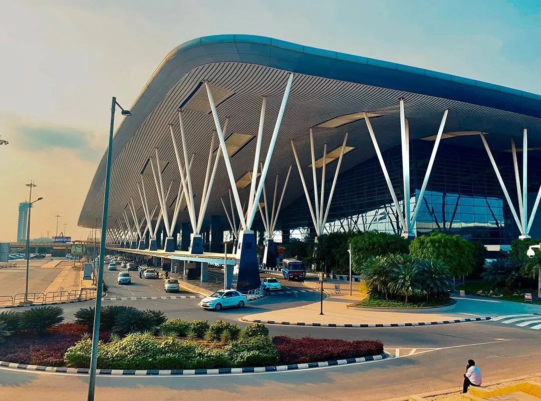
The Karnataka government has identified three possible locations for the new airport: two in South Bengaluru along Kanakapura Road, and one near Nelamangala-Kunigal Road.
Kanakapura Road (Urban Area):
Located within Bengaluru Urban district.
Approximately 4,800 acres of land have been identified.
Kanakapura Road (Ramanagara District)
Near Harohalli, close to the last station on the Green Metro Line.
Around 5,000 acres identified
Nelamangala – Kunigal Road
Around 5,200 acres of land proposed.
This site is slightly farther out but is a serious option due to available acreage.
The government has committed to providing at least 4,500 acres for whichever site is finalized.
Key Players & Progress
The Airports Authority of India (AAI) conducted a feasibility study in April 2025.
Karnataka’s Infrastructure Minister, M. B. Patil, has emphasized transparency in the decision-making process.
Deputy Chief Minister D.K. Shivakumar is a strong advocate for siting the airport near Kanakapura / Harohalli, citing industrial connectivity (especially to Electronic City).
According to Patil, the new airport could match KIA in scale, requiring between 4,500–5,000 acres.
Challenges & Concerns
While the plan is ambitious, it faces several hurdles:
Terrain & Airspace: The AAI has flagged issues such as rocky terrain, restricted airspace, and high costs.
Environmental Impact: Parts of the proposed southern sites are close to ecologically sensitive zones, such as near Bannerghatta National Park, raising concerns about environmental clearances.
Skydeck Project Conflict: A separate proposal for a 250m skydeck in South Bengaluru could clash with the planned airport due to height restrictions, potentially complicating approvals.
Land Acquisition: Acquiring thousands of acres is a massive undertaking, both logistically and socially.
Why South Bengaluru Is the Front-Runner
Connectivity: The Kanakapura / Harohalli corridor offers strong access — near Metro infrastructure and roads connected to key industrial hubs.
Passenger Catchment: Officials believe a large share of future air travellers will come from southern Bengaluru, making that region strategically important for a second airport.
Timeline: The existing KIA has a concession agreement that restricts a competing international airport within an aerial radius of 150 km — article 5.2 of the 2004 concession agreement between the Ministry of Civil Aviation and BIAL — until 24 May 2033, fifteen years from the airport’s opening date rather than from the signing.
Size Ambition: The second airport is being planned on a grand scale — comparable to KIA, not just a small auxiliary facility.
What’s Next & Why It Matters
Feasibility Report: Once the AAI submits its detailed study, the government will likely finalize one site and begin detailed planning.
Funding Model: The plan may follow a public-private partnership (PPP) structure, similar to how KIA was developed.
Long-Term Impact: A second airport could:
Alleviate congestion at KIA
Boost cargo capacity
Spur industrial development in South Bengaluru
Improve regional connectivity
Timeline: If things go smoothly, construction may take 7–8 years, meaning the airport could come online around or after 2030.
Conclusion
Bengaluru’s ambition to build a second international airport in South Bengaluru reflects both necessity and foresight. With KIA nearing its capacity, the city cannot afford to wait — especially when it’s forecasted to grow even more in the coming decade. While challenges like terrain, environmental clearances, and land acquisition loom large, the potential benefits are significant: better connectivity, expanded capacity, and infrastructure to match Bengaluru’s global aspirations.
Whether the final site lands near Kanakapura Road or Nelamangala-Kunigal, the decision will mark a pivotal moment in Bengaluru’s infrastructure journey. This isn’t just about building a new airport; it’s about shaping Bengaluru’s next phase of urban and economic growth. As the city evolves, developers like SUYUG Infra continue to align their vision with Bengaluru’s future-ready infrastructure, creating thoughtfully designed communities that benefit from improved connectivity and rising development opportunities.
What "Announced" Actually Means for a Buying Decision
A second airport at the feasibility-study stage is not a committed asset yet, and treating it as one is the most common mistake buyers make around any large infrastructure announcement. Between a feasibility report and a runway taking its first flight sit several distinct, sequential stages — site finalisation, land acquisition, environmental and airspace clearances, financial closure (often under a public-private partnership), and construction — and each stage can independently stall, get re-sited, or get re-scoped without the project being cancelled outright. None of that is unique to this airport; it is how large infrastructure is built anywhere in India, and it is exactly why this article states each fact with its source and its date rather than as settled history.
How to verify status yourself, rather than rely on a broker's word
- Go to the primary source, not a resale of it. The Airports Authority of India and the Ministry of Civil Aviation publish their own updates; a broker's WhatsApp forward of a news clipping is not a substitute for reading the underlying government statement.
- Separate "identified land" from "acquired land." A government identifying acreage for a purpose is a planning step; it is not the same as the land being acquired, compensated, and transferred. The distance between those two events, for large land parcels in India, is frequently measured in years rather than months.
- Check what stage a specific clearance is at. Environmental clearance, forest clearance where applicable, and airspace clearance from the AAI are separate approvals with separate timelines. A project can clear one and stall on another for an extended period.
- Read the concession terms of the existing airport, not just this article's summary of them. The 2004 concession agreement between the Ministry of Civil Aviation and Bengaluru International Airport Ltd is a public document; if a timeline matters to your decision, read the clause itself rather than a paraphrase of it.
Why this matters more, not less, for property near a proposed site
Infrastructure that is merely proposed carries a different kind of risk than infrastructure that is under construction or complete: the upside is not yet priced in everywhere, but neither is the downside of a re-siting or a multi-year delay. A buyer evaluating any location on the strength of a future facility — an airport, a metro extension, a ring road — should underwrite the purchase on what exists and is registered today: the project's own RERA registration, its sanctioned plan, and its current state of construction. A future amenity is a reasonable factor in a long-horizon decision; it should never be the only one, and it should never be allowed to substitute for the checks that apply to every property purchase regardless of what gets built nearby. SUYUG's own THE1 and Saffron communities, both on the Sarjapur Road corridor, are evaluated on that same basis — their own K-RERA registrations and current construction status, published on their respective project pages, rather than on any announced but unbuilt infrastructure nearby.
Was this useful?
Comments
Was this useful?
Schedule a site visit
Leave your details and the team will call back to fix a convenient date.