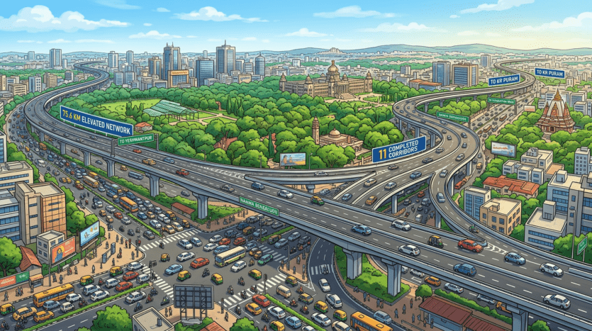
Bengaluru’s Big Traffic Fix: 75.6 km Flyover Network Approved
Bengaluru’s ₹13,262 Cr Flyover Revolution: Traffic Relief Ahead
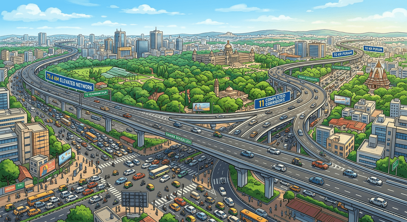
Bengaluru drivers can breathe easier. On April 17, 2026, the Karnataka Cabinet greenlit a massive 75.6 km network of 11 flyovers and elevated corridors, costing ₹13,262 crore. This ambitious project promises to slash congestion and connect all five municipal corporations seamlessly.
Core Infrastructure Boost
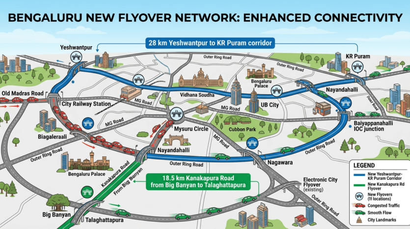
The centerpiece is a 28 km elevated corridor from Yeshwantpur to KR Puram, easing north-south bottlenecks. Another key stretch runs 18.5 km along Kanakapura Road from Big Banyan to Talaghattapura, targeting southwest traffic woes. Additional flyovers will link hotspots like Old Madras Road, City Railway Station, Mysuru Circle, Nayandahalli, and Nagawara.
Execution and Timeline
Bangalore Smart Infrastructure Ltd (B-SMILE) leads the charge after a two-year traffic study. Minister H K Patil and B-SMILE’s B S Prahallad hailed it as a game-changer for urban mobility. Construction timelines remain pending, but approval marks a swift start.
Bonus Projects
A ₹436.44 crore elevated rotary flyover at Baiyappanahalli IOC junction includes a two-lane rail overbridge and a one-lane overbridge. These enhance central-to-northern links. The cabinet also nodded to PPP-based sewage sludge treatment and Intermediate Ring Road updates.
Economic Impact
Bengaluru’s ₹13,262 crore flyover network will stimulate local economies by reducing commute times for over 5 million daily commuters. Faster connectivity from Yeshwantpur to KR Puram boosts IT hubs in Whitefield and Manyata Tech Park, drawing investments in real estate and logistics. Search terms like “Bengaluru traffic solutions 2026” and “elevated corridors Bangalore” highlight growing interest in infrastructure-led growth.
Key routes like Kanakapura Road flyover target high-density areas, easing congestion for NRI investors and HNI residents searching “Bengaluru real estate flyover impact”. With B-SMILE’s traffic study ensuring data-driven design, this project positions Bengaluru as India’s top smart city for “urban mobility upgrades 2026”. Expect 30-40% travel time cuts, perfect for professionals optimizing daily routes amid “Bengaluru flyover network updates”.
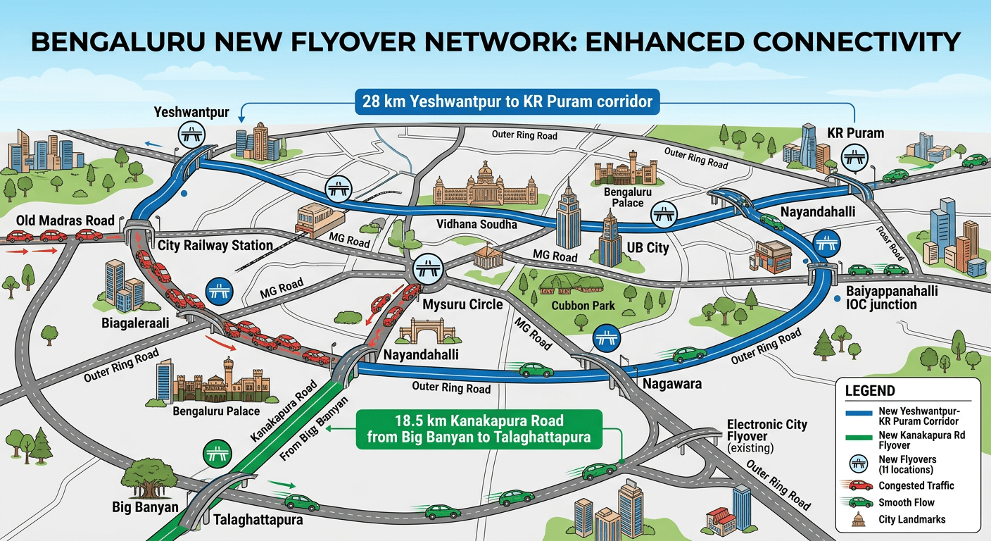
This map visualizes the 75.6 km network’s strategic layout across Bengaluru’s key zones.
Why It Matters for Bengaluru
With Bengaluru’s traffic notorious for hour-long crawls, this network could reclaim lost hours for residents. As a digital hub, faster commutes mean boosted productivity—perfect for techies and entrepreneurs navigating the city daily. Stay tuned for ground-breaking updates.